博文

Homework 4

图片
 Homework 4      This picture shows the air pollution data in Taiwan in October and November, and shows the changes in pollutants between these two months. As can be seen from the figure, most areas are displayed in green, indicating that the air quality in most areas is healthy. A small part of Zhanghua County is displayed in red, indicating serious air pollution. There are more green areas in Taipei and Tainan and the air quality is better. Therefore, Taipei and Tainan are more suitable for living.

Homework3

图片
      Question 1: Question 2:      The QuickOSM plugin is particularly useful in practical scenarios, such as identifying healthcare locations on a map. In a GIS project focused on public health, one can employ QuickOSM to efficiently retrieve relevant data from OpenStreetMap.         For example, imagine a city planning project aiming to assess healthcare accessibility. By utilizing QuickOSM, you can easily extract data on healthcare facilities, such as hospitals, clinics, and pharmacies. The plugin allows you to specify tags related to healthcare amenities and define the geographic area of interest. In this case, you might select tags like "amenity=hospital" or "amenity=clinic" and set the extent to cover the entire city.      QuickOSM then swiftly retrieves the OSM data for healthcare facilities within the specified area, populating your GIS project with up-to-date and accurate information. This data can be further analyzed to evaluate the distribution of healthc

Homework 2 Madou District Map

图片
  BUFFER:

Lesson 2023/11/20

图片
 

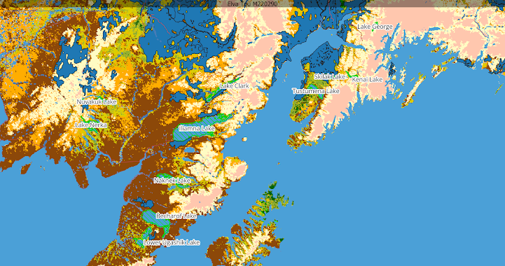
Alaska

图片
 

Homework 1

图片
                         The datasets available on this website, including cinema, museum, bus stop, and public market data, offer valuable information for future GIS projects.  The cinema dataset allows for spatial analysis and visualization of cinema distribution, aiding in urban planning and market research for the film industry.  The museum dataset provides insights into cultural heritage preservation, tourism planning, and educational initiatives.  It enables the identification of museum clusters and their proximity to other amenities.  The bus stop dataset is crucial for transportation planning, allowing for transit network creation, route planning, and accessibility analysis.  It helps identify areas with inadequate public transportation infrastructure.  The public market dataset aids in urban planning, economic analysis, and public health studies.  It identifies areas with limited fresh food access, enabling strategies to improve food security and equitable access.  These datas